Barns of Mackinac County, Michigan
135 Barns plus a few "extras"
R.V. ("Dick") Dietrich
Professor emeritus C.M.U.
|
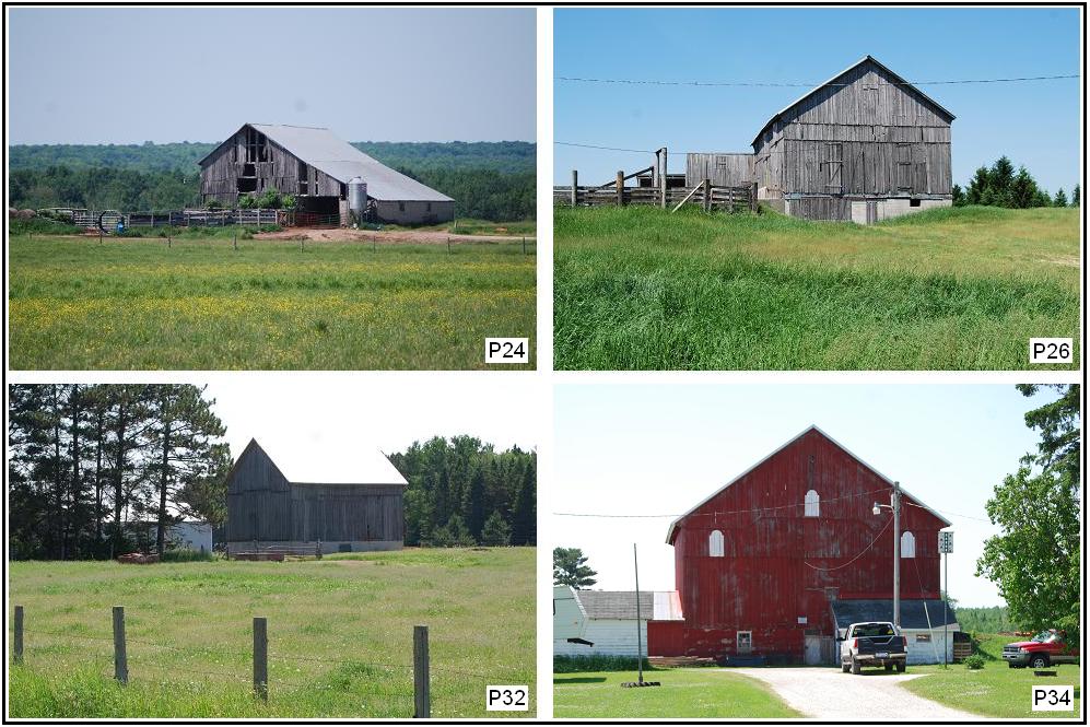
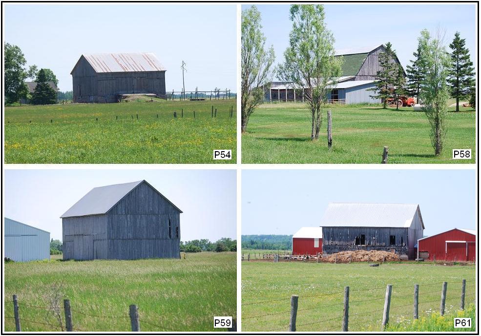
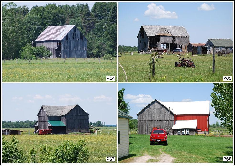
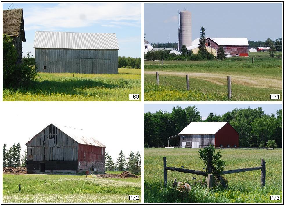
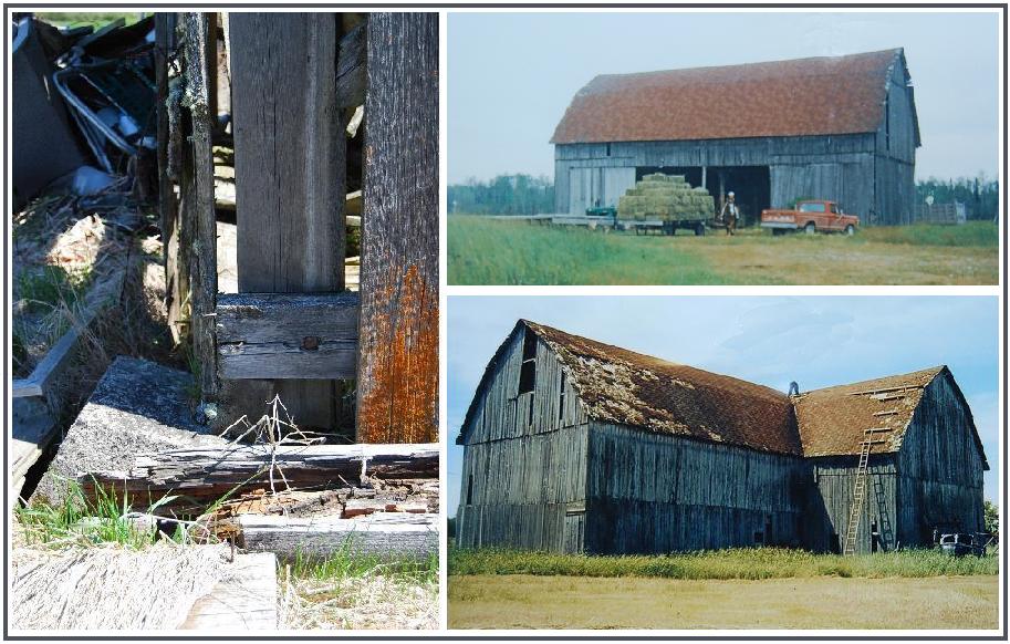
Marquette Township The number following the letter P -- e.g., P14 -- on each of the photographs of the four-photo composites is the number given that barn in the Pickford publication (ibid.). It is given to facilitate comparison of the condition of the barn when photographed for that publication and its condition in the Summer of 2011. The captions give the number assigned in this report, the location of the barn, and (enclosed in parentheses) the number of the barn, the reported date of construction (n.d. means no date given), and the page reference of information given about the barn in the Pickford report. |
|
|
|
|
|
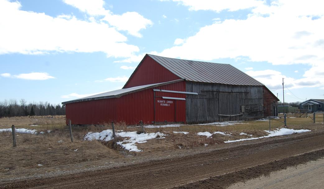
Ma2. (south of St. Ignace Rd.; NE� sec.9, T.42N.-R.2W.) The "Nunn's Creek Kennels" portion of this structure is said to have been added by John Jamieson in the last "twenty-five or so" years. Other information for this barn has not been forthcoming. |
|
|
|
|
|
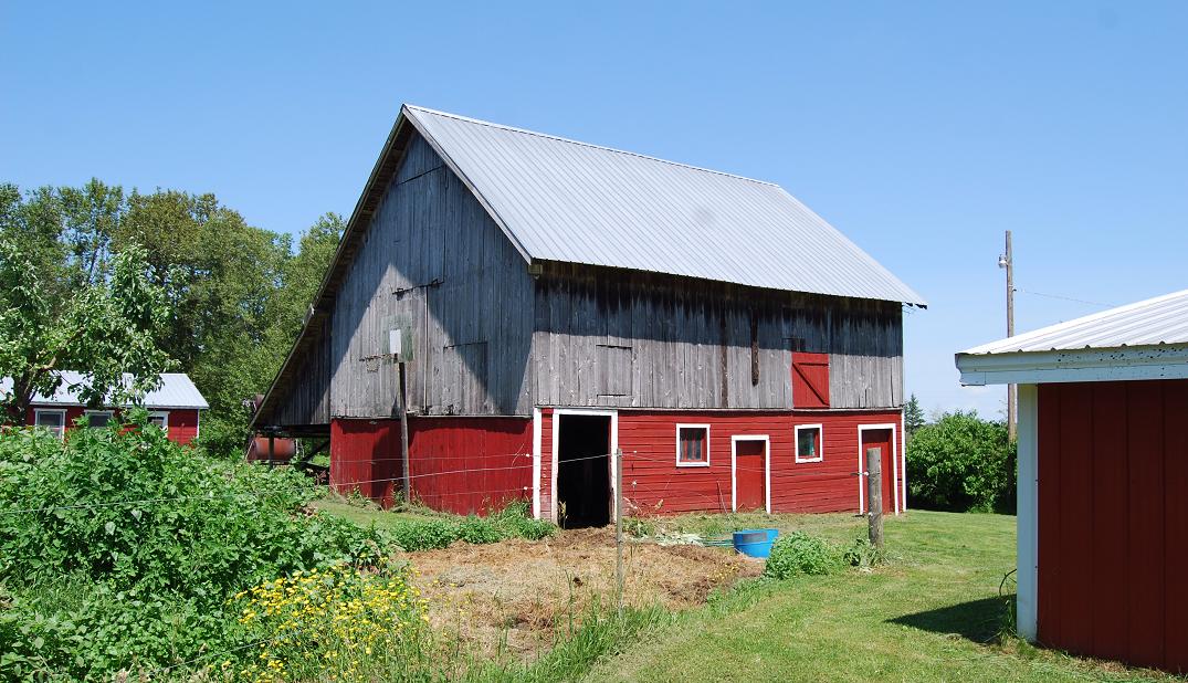
Ma4. (north of Taylor Rd.; SE� sec.9, T.43N.-R.1W.) This barn is known to have existed before the 1910s flu epidemic. It is thought likely to date back to the late 1800s or early 1900s and to have been built for the Rutledge family whose homestead was on this property. After its early use as a typical farm barn, Mackinac Island horses were wintered in it for several years. The last full time "resident" was a 26-year-old horse, who was in it in early 2011. |
|
|
|
|
|
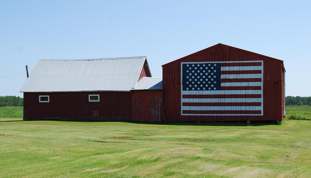
Ma5. (south of Taylor Rd.; NW� sec.14, T.43N.-R.1W.) This barn, which has housed cows and horses and their feed in the past, is said to have been built "more than fifty years ago" for Wally Beacon. For a number of years, and when it was photographed (early summer, 2011), it was used chiefly to store hay prior to its being shipped to Mackinac Island. The 20 x 13-foot flag was painted on the one section of the barn, after "9/11," by Mike Newton, the current owner. Unfortunately, this barn burned up on September 1, 2011, apparently because of an electrical problem. |
|
|
|
|
|
|
|
|
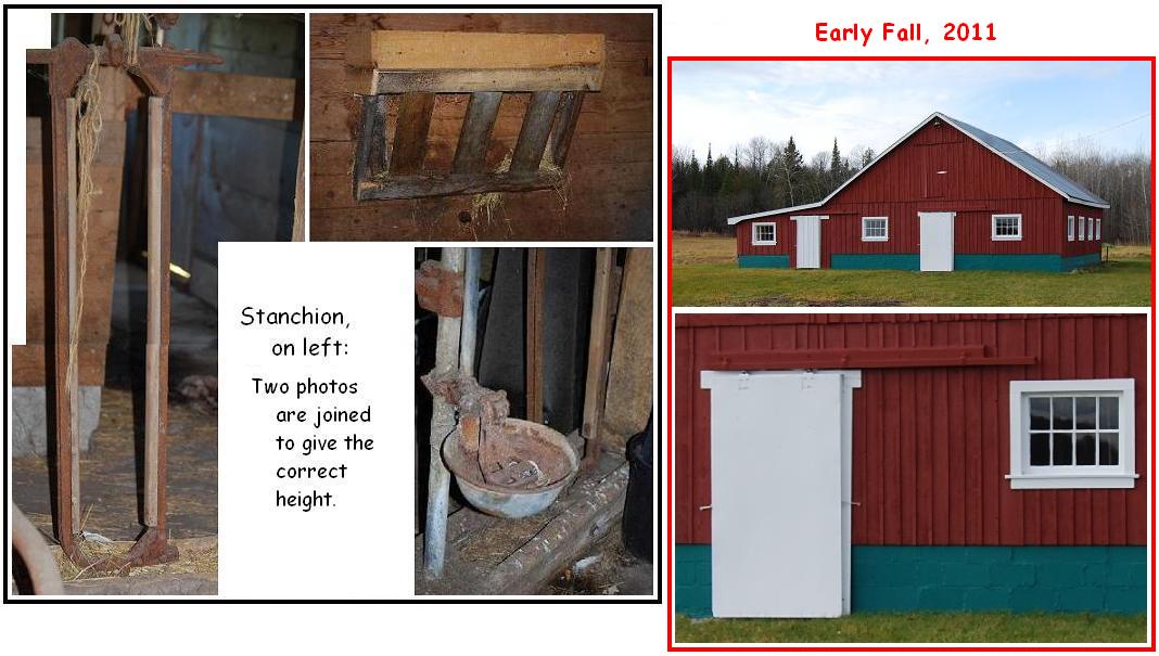
Ma6. (west of Rte. 48/129; NE� sec.24, T.43N.-R.1W.) This barn was apparently built in the 1910s. The nearby house of the original owners, Howard and Thelma (nee Gough) Adams, is dated as 1913/14. The barn still contains several old stanchions and two box stalls, apparently for workhorses, as well as a rather large hayloft; some of these features are shown in the composite on the left, below the main photograph. These photographs were taken in the early summer of 2011. Since then, Teri Kniss, the current owner, has had the exterior of the barn rejuvenated; see the two photographs with the red border that are to the right below the main photograph. She plans to have the interior redone in the near future. |
|
|
|
|
|
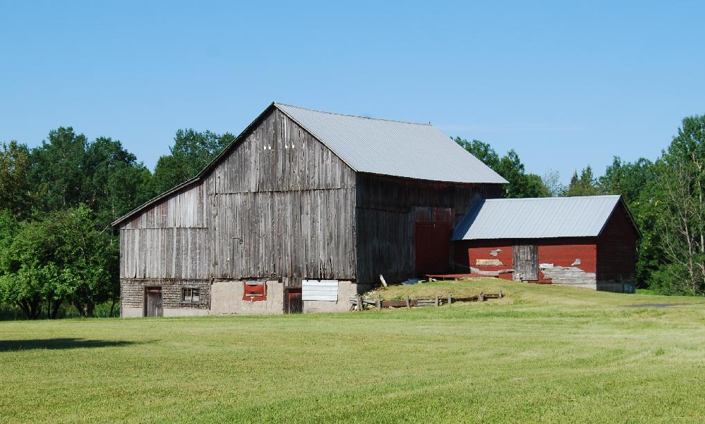
Ma7. (west of Rte. 48/129; NE� sec25, T.43N.-R.1W.) This barn is said to date to the 1920s, and perhaps earlier. The reason for part of the lower level being covered with shingles is not known; I did not gain admittance so was unable to see if, for example, the shingles cover logs above the concrete base of that section. The smaller, later attached structure with horizontal board sides, which is on the front, right, side of the barn was a granary. The owner said that stanchions and attached water cups are still in the barn and that a grist mill is still in the granary. |
|
|
|
|
|
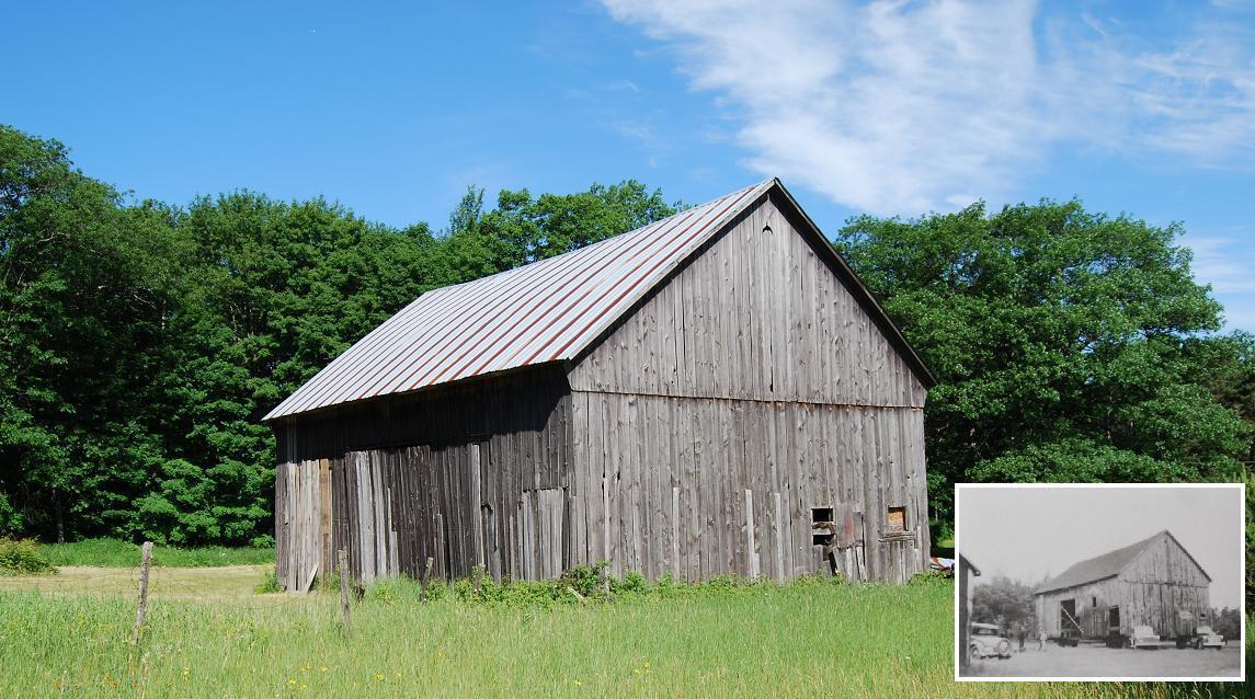
Ma8. (south of Rockview Rd.; NW� sec.36, T.43N.-R.1W.) This barn is thought to have been built in the early 1900s. It was originally about a half mile west of its present location. It was moved from that location, then known as the John Mitchell place, to its present location in the 1940s. The inset photograph (courtesy Nancy Cornwell) was taken during that move. That photograph also shows the side and end of the barn not shown in the main photograph. The barn housed dairy cows until the 1970s and subsequently beef cattle until fairly recently. The rafters of this barn provide a good example of those that are connected to the posts with wooden pegs. |
|
|
|
|
|
MaP-1. (south of Townline Rd.; NW� sec.1, T.43N.-R.1W.) (= #56, n.d., p.28) |
|
|
|
|
|
MaP-2. (south of Townline Rd.; NE� sec.6, T.43N.-R.1W.) (= #24, ~1947, p.16) |
|
|
|
|
|
MaP-6. (south of Townline Rd.; NW� sec.2, T.43N.-R.1W.) (= #54, n.d., p.27) |
|
|
|
|
|
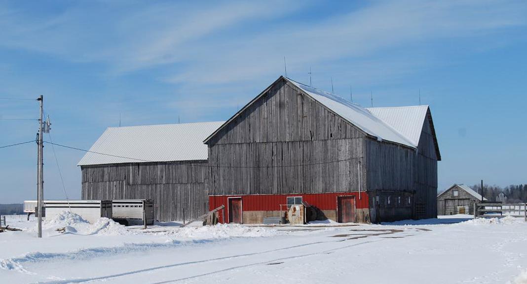
MaP-10. (west of 1 Mile Rd.; SW� sec.2, T.43N.-R.1W.) (= #62, n.d., p.30) This barn is shown differently because the photo was taken in the winter -- i.e., March 15, 2011. |
|
|
|
|
|
MaP-11. (north of Blair Rd.; SW� sec.2, T.43N.-R.1W.) (= #64, n.d., p.31) |
|
|
|
|
|
MaP-15. (south of Taylor Rd.; NE� sec.14, T.43N.-R.1W.) (= #69, ~1921, p.33) |
|
|
|
|
|
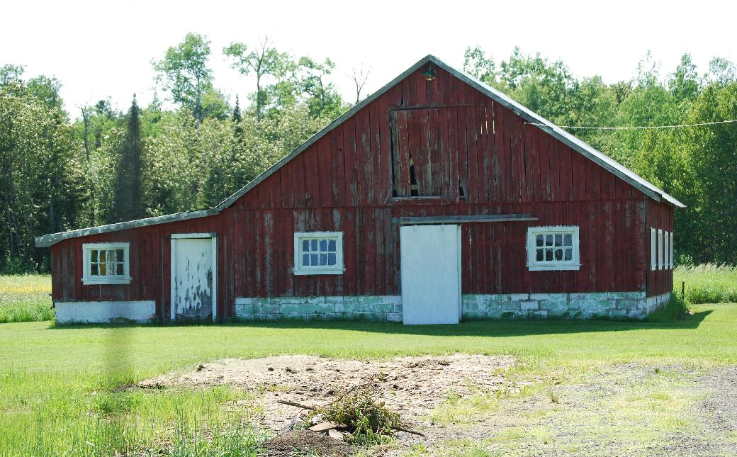
MaP-19. (south of Blair Rd.; NE� sec.12, T.43N.-R.1W.) (= #57, n.d., p.28) This reason that this barn is shown differently from those of this sub-group is that it was not seen on my first drive through the area.
|
|
|
|
|
|
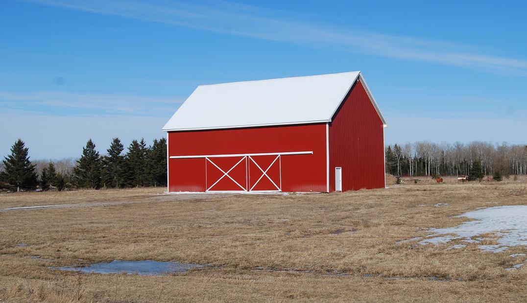
Ma1. (east of Simmons Rd.; SW� sec.30, T.43N.-R.2W.) Extra no. 13: This structure is a "steel skin" on a mid-20th century hay barn (Martin Kopinski, its owner, p.c. 2011). Kopinski described the older structure as follows: It was built of timber with rough-sawn lumber sides, both of which were chiefly pine. At one time, the sides and ends were covered by cedar shakes, and the roof had asphalt atop cedar shingles. Nearly all the interior posts, beams, and rafters are those of the original barn. The floor is dirt; the vertical wall and posts, of which there were 20, were based on concrete piers that were formed in 55-gallon drums. The footings were replaced before the "steel skin" was added because some of the posts had moved -- so-to-speak walked -- off the centers of the original piers. This barn closely resembled the former barn shown in the composite photograph of the Ma3 entry (q.v.). The exterior "steel skin," shown in this photograph, was added in 2008. This structure is designated as an Extra because I have not had access to, and thus do not know first-hand about, its interior. (cf. Ga59, an old wooden barn, now covered with metal, the interior to which I have had access.) |
|
|
|
|
|
|
|
|
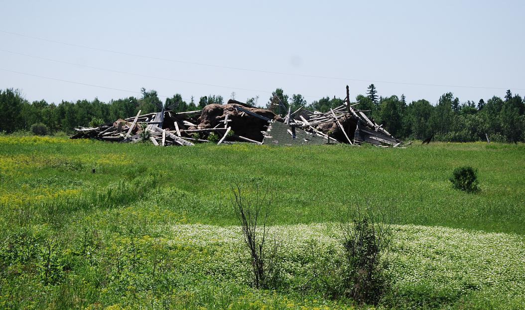
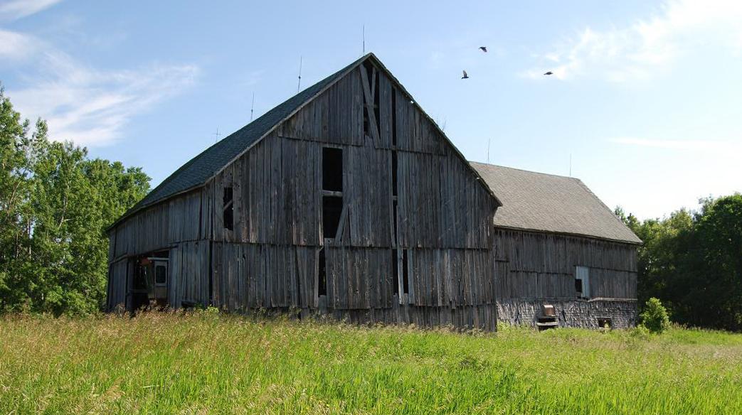
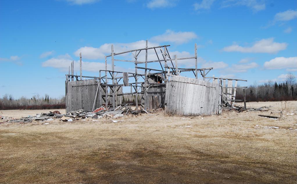
Ma3. (north of St. Ignace Rd.; SE� sec.4, T.42N.-R.2W.) Extra no. 14: What was left of this barn in the early summer of 2011 is a good example of what has happened and continues to happen to barns, especially to those the roofs of which have not been kept in good repair. Since then -- i.e., by early fall, 2011 - all the structure except the concrete floor and pillars upon which the upright posts were resting has been removed. The former barn was built in 1932. The original owner was George Lamoreaux. The composite shows: Right, the barn, before its demise -- i.e., as it appeared in 1997. The top photo shows the west side; the bottom photo is a view from the southeast. (These photographs were taken by Kathy Lamoreaux McCabe, of Watertown, New York -- another coincidence because that is the city in which I lived from 1925 until 1938.) The main part of this barn is said to have been similar in many aspects to the one that now has a "steel skin" -- i.e., Ma3 (q.v.). Apparently the two main differences between these two barns were: 1) This barn was larger than that one. [and] 2) That barn did not have the "T" area, which is shown on the east side of this barn. The composite: Left, this tilted pillar and off-center post provide an example of one of the features attributed to the "walking barn" phenomenon. Briefly, this hypothesized phenomena involves movement of one or more of a barn's posts atop the concrete pillars upon which they were placed but not secured -- i.e., the posts were merely set upon the concrete piers. Apparently they were not attached to the piers because it was presumed that the weight they bore would keep them in place. The movement -- i.e., the "walking" -- is widely believed to be caused by high winds' blowing against the large broad sides of these barns. But, other things such as earth movements or even off-center placements of large quantities (i.e., weights) of, for example, hay in their lofts seem likely to have been alternative or subsidiary causes of the movements of the posts. In any case, the tilted pillar that is shown is thought to have been a response to such "walking" and the consequent shifting of the weight of the barn. And, even this seems likely to be an oversimplification -- e.g., such things as differences in the subsoil beneath different parts of the piers and even frost action may also have been involved. |